


WITH UNMATCHED CAPACITY, WE'LL GET THE JOB DONE
Streamlining renewable energy and transmission developers through permitting and compliance.
Cultural Resource Management Services
Trailblazing
Technology Solutions
Discover how we can help you secure permits, meet compliance requirements, and give you peace of mind
Realize extraordinary quality and unprecedented efficiency with our industry-leading technology solutions
PRIMARY SERVICES
- Archaeology
- Heritage Preservation
- Underwater Archaeology
- Tribal Consultation
- Cultural Landscape
- Paleontology
- Architectural History
TECHNOLOGY SOLUTIONS
- Aerial Mapping
- 3D Modeling
- GIS Mapping
- Enhanced Artifact Illustration
- Augmented and Virtual Reality
- Enhanced Feature Mapping
- LiDAR
- Story Maps
PEOPLE ARE TALKING ABOUT CHRONICLE HERITAGE
“Your use of innovative technologies facilitated quick access to data
and allowed forms and maps to be stored in the cloud, thus avoiding
lost information. Presented with an extremely compressed schedule, you succeeded in completing the field investigations on time.”
Curtis Winner
Director of Safety and Technical & Land Services, NMGC
INNOVATIVE SOLUTIONS FOR COMPLEX CHALLENGES
From 3D modeling to drone imaging, our comprehensive technology solutions tackle even the most complex heritage management challenges, saving you time and resources. We work closely with federal agencies, AE firms, and tribal consultation groups to deliver tailored solutions that meet your unique needs and objectives.
LiDAR
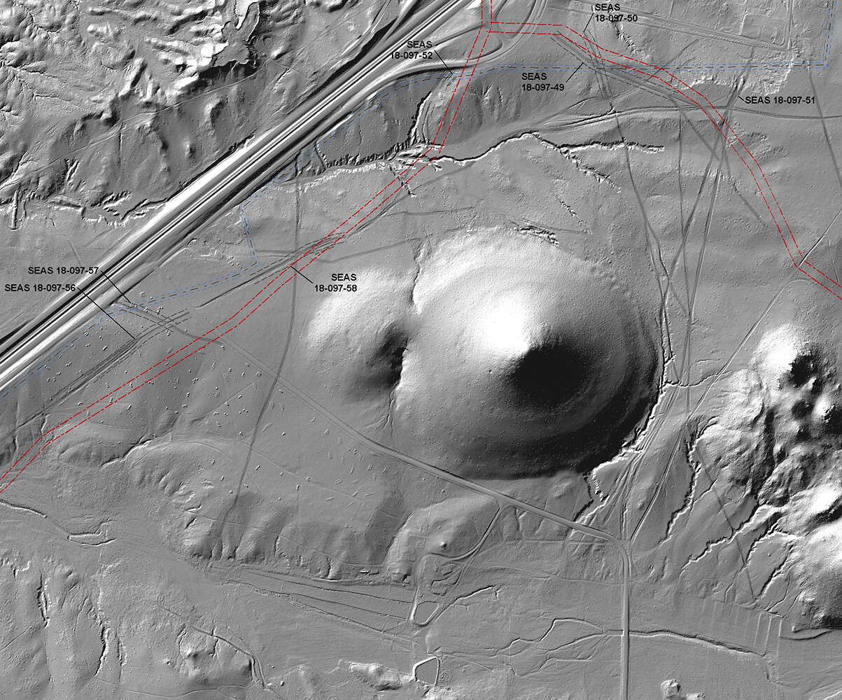
El Camino Real Alignment (from NPS)
Overlaid on LiDAR Elevation Model
Santa Fe County, New Mexico
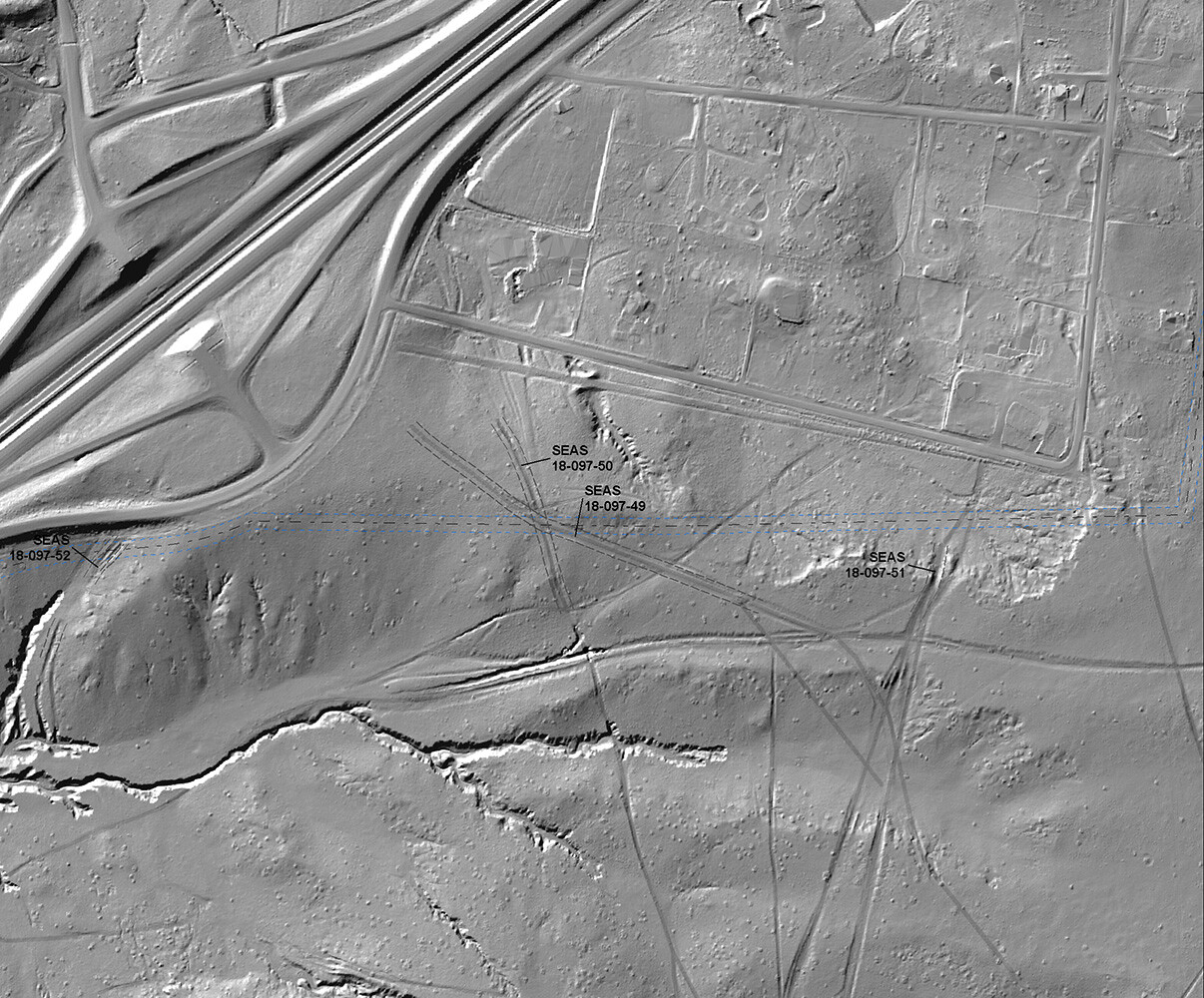
Historic Trail Alignments as Observable in LiDAR
Elevation Model (Northern Extent)
Santa Fe County, New Mexico
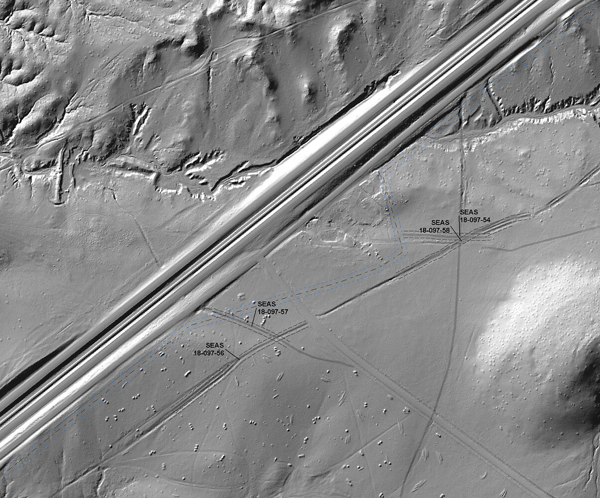
Historic Trail Alignments as Observable in LiDAR
Elevation Model (Southern Extent)
Santa Fe County, New Mexico
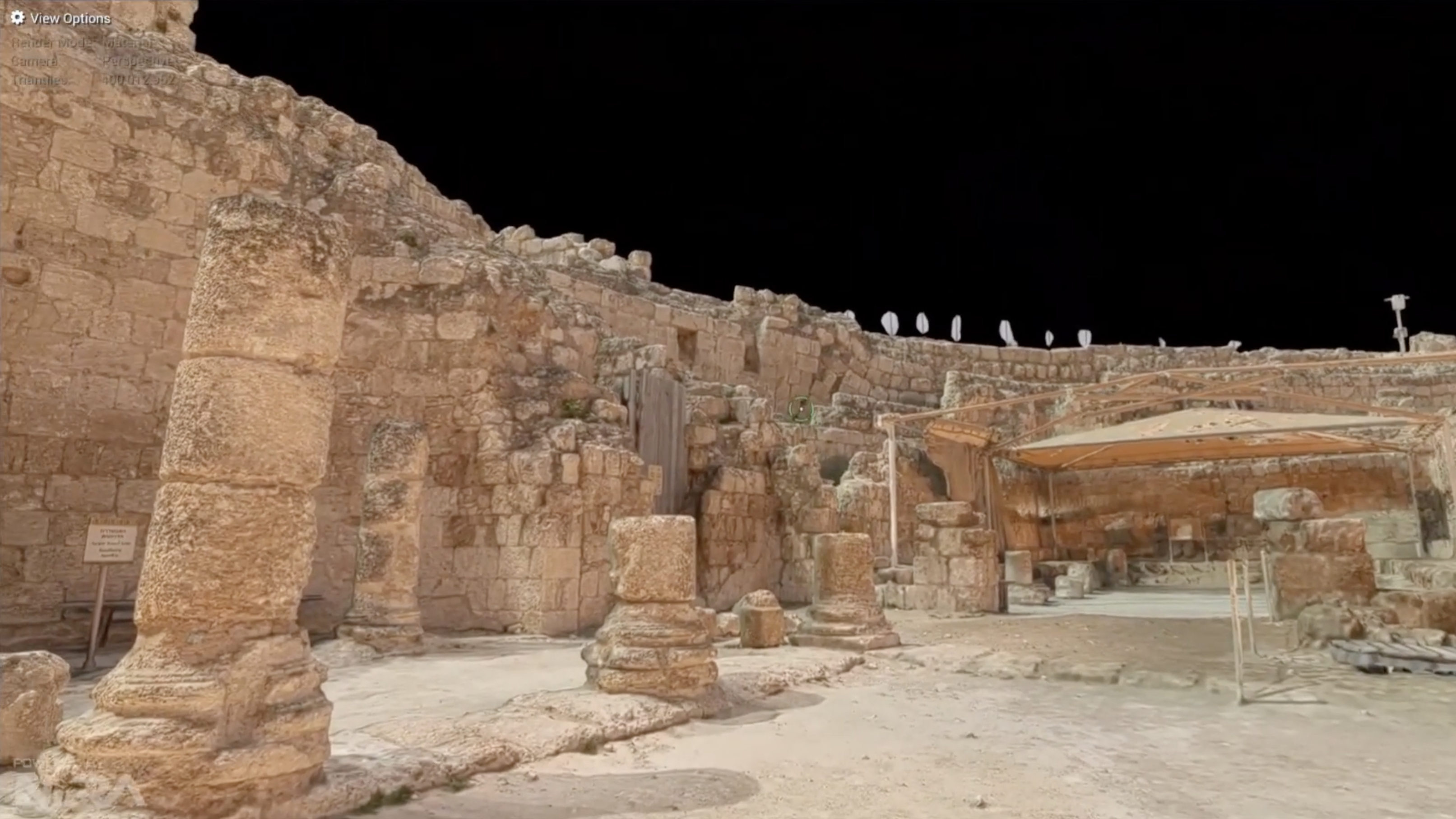
Chronicle Heritage is an industry leader in 3D solutions and proficient in both ground-based and aerial-based techniques for capturing 3D model data.
Our use of 3D modeling has made a significant contribution to the preservation of our shared history by better documenting, analyzing, restoring, and educating others.
Our 3D modeling capabilities, which include LiDAR and photogrammetry, are completely noninvasive and nondestructive.
These services can provide creative mitigation options for cultural resource projects. For example, an increasing number of tribes have recommended 3D modeling as a mitigation option for tribal cultural resources following California’s implementation of Assembly Bill 52.

3D MODELING:
Artifact Illustration, Modeling, and 3D Printing
Individual objects from project or museum collections can be quickly modeled for digital preservation and 3D replica printing. For project sites under threat from looting or other kinds of destruction, 3D modeling provides a precise digital record to assess the condition of a resource and, if necessary, even reconstruct it in the future.
Shown left:
Bone Tube 1, Entrance Chamber, Slate Cave
Pacbitun Regional Archaeological Project (PRAP)
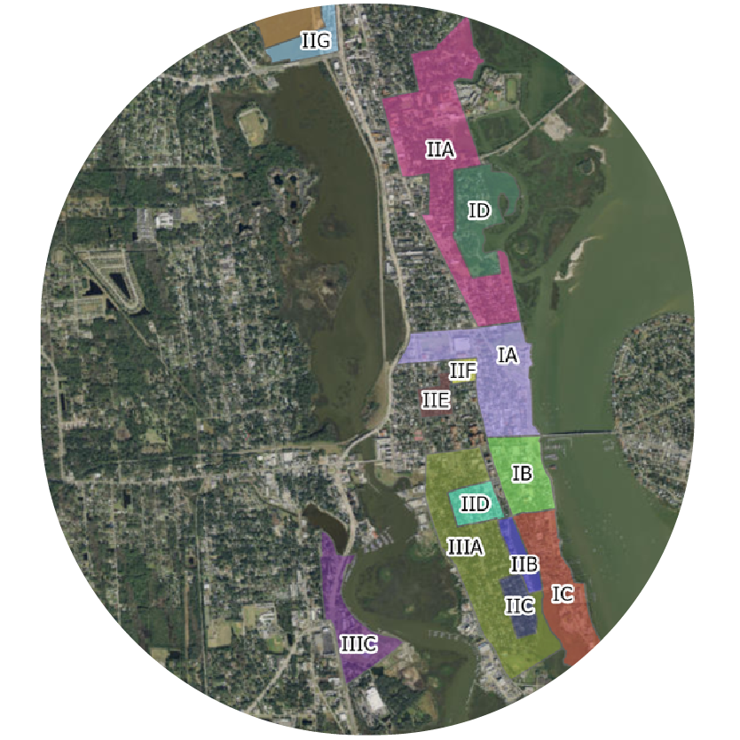
Reexamining St. Augustine's Archaeological Zones
GEODATABASE ALLOWS FOR MORE PRECISE PLANNING FOR FUTURE URBAN DEVELOPMENT
Chronicle Heritage partnered with the City of St. Augustine, Florida in compiling a wide array of historic data sets into a single cumulative geodatabase for use by the city.
By overlaying historical and archaeological data with current land-use information, the municipality could better identify areas of cultural and historical importance that required protection or special consideration.
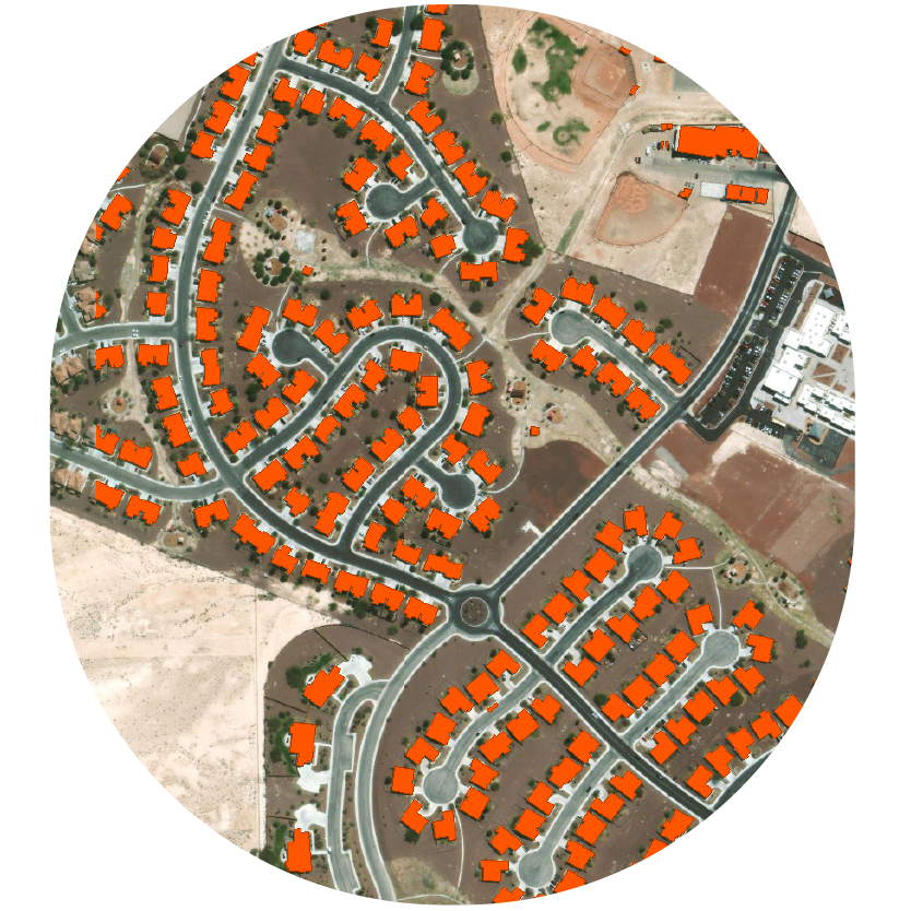
Structural Footprint Extraction from LiDAR Imagery for the Department of Defense
UTILIZING AUTOMATION TO RAPIDLY GENERATE AN UPDATED DATASET OF HISTORIC STRUCTURE FOOTPRINTS
As a part of a larger Department of Defense contract, Chronicle Heritage was asked to digitize the footprint of historic structures within a military installation. The initial results would have been imperfect, which our in-house GIS team resolved by exploring alternative methods to extract missing information